
Belknap Mountain Range Maps
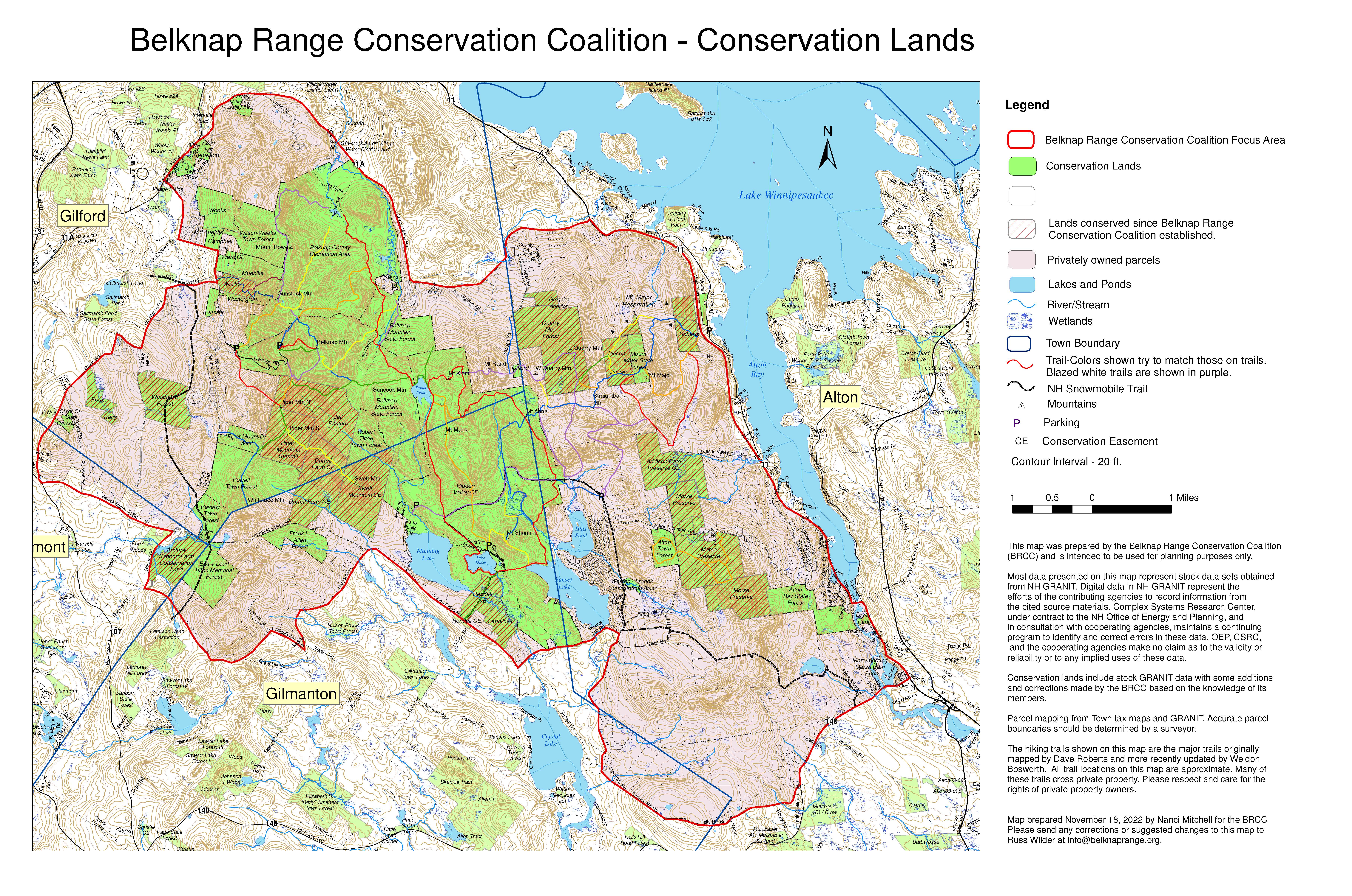
This map shows the large parcels in the Belknap Range which have been conserved by a governmental agency or land trust, either through fee ownership or by conservation easement. Note that lands conserved by a conservation easement are privately owned and may not be open to the public for pedestrian access. BRCC started meeting in 2006 as a group (first formative meetings with very few people were in 2005) and acquired NH non-profit status in 2008. Since 2006 nearly 3800 acres have been conserved in the range. To see a spreadsheet with parcels, acres and years, click "Read More" below. BRCC helped facilitate the conservation of these lands by working with coalition members.
This map shows the numerous hiking trails in the Belknap Range and was provided by Weldon Bosworth. Please note that many of these trails cross private property. Please respect and care for the rights of private property owners. Paper copies of the trail map on 11”x17” paper in color are available at the Alton, Gilford, Gilmanton, and Laconia libraries for a small fee.
Belknap Range Trails 2023
Click Image to Open a High-Resolution PDF
Hiking information for trails on each of the following mountains in the Belknap Range.
Originally published in the Gilford Steamer